
Description
About
Description
About
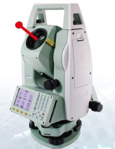
Key Features – LYNX LTS4 Total Station
-
2-Second Angular Accuracy – Ensures precise measurements in all field conditions.
-
Fast & Accurate EDM – High-speed measurement with reliable accuracy.
-
Long Range Measurement –
-
5000 m with single prism.
-
6000 m with three prisms.
-
500 m reflectorless range.
-
-
Dual-Side Graphical Color Displays – Clear, easy-to-read interface for enhanced usability.
-
Versatile Applications – Supports stakeout, area projection, resection, offset, and coordinate (X, Y, Z) functions.
-
Rugged, Weather-Resistant Design (IP65) – Dustproof and waterproof for harsh field environments.
-
Large Internal Memory – Stores approximately 20,000 points with USB and SD card support.
-
Bluetooth & USB Connectivity – Allows fast and efficient data transfer.
-
Long Battery Life – Up to 16 hours of continuous use with rechargeable Li-ion battery (BT10).
-
Ergonomic & Lightweight Build – Easy to carry, weighing approximately 5.5 kg including battery and tribrach.
-
Dual-Axis Tilt Sensor – Ensures accurate angle measurement with ±3′ accuracy.
-
Real-Time Operating System (UDOS) – Smooth operation and quick data processing.
Applications / Use Cases
-
Construction & Civil Engineering.
-
Road and Bridge Alignment.
-
Topographic and Land Surveys.
-
Mining and Geological Surveys.
-
Infrastructure & Urban Planning.
Related products
-
 Mobile Mapping System
Road SIT Airport PMS
-
Mobile Mapping System
Mobile Mapping System Road Scanner 4
-
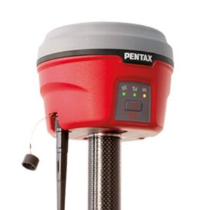 GNSS SYSTEM
Pentax GNSS Receiver G6 Series
-
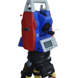 LYNX TOTAL STATION
LYNX Electronic Total Station – Model LTS2

Reviews
There are no reviews yet.