Surveying is a highly technical and exact engineering procedure that involves the collection and analysis of data using specialized surveying instruments and techniques. This data is utilized to create precise maps, blueprints, and models that are required in a number of industries.
Surveying is essential in a variety of sectors, including building, mining, and civil engineering. It is used to plan and develop new infrastructure, evaluate environmental effects, and analyse natural catastrophe risks.
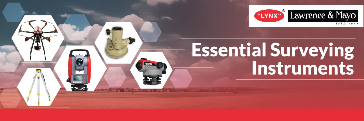
What are the most common SURVEYING Instruments?
Surveying instruments are specialised equipment that land surveyors use to measure and map the earth’s surface. The complex nature of these instruments ranges from simple surveying equipment like plane tables, measuring tapes and dumpy levels to sophisticated technology like Total Stations, Laser Scanners, and GNSS receivers.
Distance measurement, angle measurement, and elevation measurement are all important surveying procedures. Total stations, GPS receivers, theodolites, and automatic levels are the commonly used surveying equipment amongst others. Surveyors also employ a variety of accessories and equipment, such as levelling rods, prisms, and measuring tapes, in addition to these instruments.
List of surveying instruments:
Total Station :
A total station is a high-precision instrument that combines the functions of a theodolite and a distance meter in land surveying. It is used to precisely measure angles, distances, and altitudes. This equipment is frequently utilised in building, engineering projects, topographical and hydrographic surveys, and various other industries.
Auto Level/Dumpy Level:
A level auto used in surveying to evaluate height differences and establish horizontal levels is known as an auto level or a dumpy level.
Theodolite:
A theodolite is a precise tool for measuring angles in both the horizontal and vertical planes. It is frequently used in land surveying, building, and engineering applications. Theodolites are essential tools for measuring angles accurately in surveying.
GPS (Global Positioning System):
GPS is a satellite-based positioning system that provides users all over the world with precise location information. It’s frequently used in land surveying, mapping, and navigation, and it provides precise position data for a variety of applications.
Photogrammetry/Drone:
Photogrammetry is the science of measuring objects using photos. Drones with cameras may take high-resolution photographs of the earth’s surface, which can then be used to produce comprehensive maps and 3D models. Drones and photogrammetry together with GNSS systems are crucial tools for topographical and quality surveys.
Optical Square:
An optical square is a tool for measuring right angles accurately. It was frequently used in land surveying, building, and engineering applications. Now days it has been replaced with the total station /theodolites
Roof and ground plummet:
Roof and ground plummet is a gadget that is used to transfer the ground point to your roof to establish a vertical reference line. It is extensively used in construction of towers and in the mining industry.
LDM (Laser Distance Meter):
A laser distance meter is a portable gadget that measures distances accurately. It is extensively used in building and engineering projects.
Prismatic Compass:
A prismatic compass is a type of surveying instrument that is used for determining direction and bearing. It is widely used in land surveying and navigation because it provides precise direction and orientation data.
Prisms:
In land surveying, prisms are used to reflect and redirect light, allowing for precise measurement of distances and angles. They are frequently used in conjunction with total stations and are always mounted on a pole.
Levelling Staff:
A levelling staff is a rod used to measure height differences in conjunction with the automatic levels and establish horizontal levels. It is frequently used in land surveying, building, and engineering applications.
Bipods:
Surveying equipment/ prism with pole is supported by bipods, which provide a sturdy basis for precise measurements. They are often used in land surveying, building, and engineering applications.
Measuring Wheel:
A measuring wheel is a gadget that is used to measure distances on the ground. It is extensively used in land surveying, building, and engineering applications to provide rapid and precise distance measurements.
Tripod:
A tripod is a three-legged platform that is used to support surveying tools. It is widely utilised in land surveying, building, and engineering projects, where it provides a strong foundation for precise measurements.
The most common uses of surveying equipment are:
- Land surveying:
- Quantity surveying:
- Topographical surveying:
- Hydrographic surveying:
- Mine surveying:
- Geodetic surveying:
- Construction surveying:
In conclusion, surveying tools are critical in correctly measuring angles, distances, and elevations in a variety of industries. Surveying has grown more precise, efficient, and cost-effective with the availability of modern devices like total stations, GPS, and photogrammetry drones. Choosing the correct instrument for the work is critical for generating precise and dependable results, which will eventually lead to the successful completion of the project.