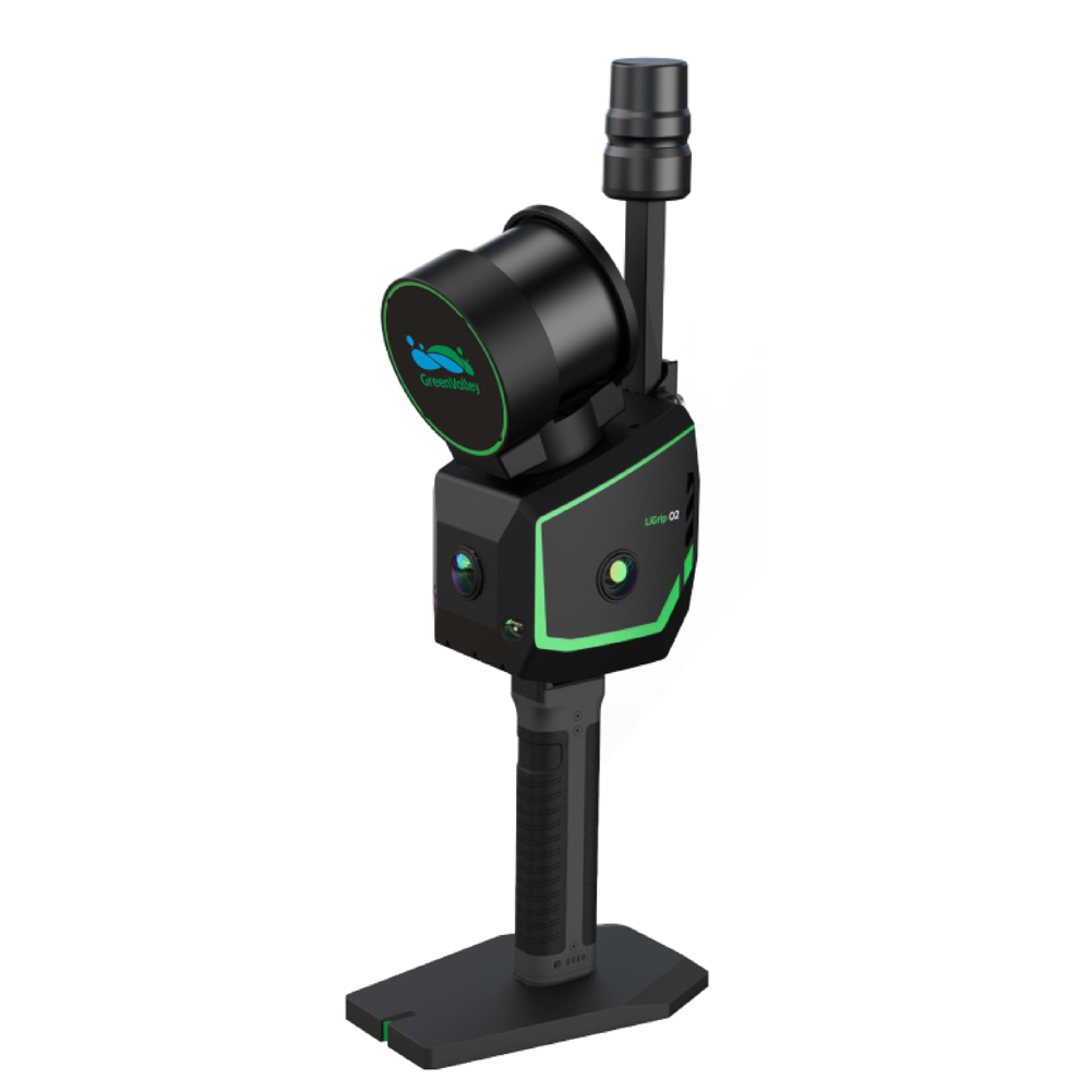
LiGrip O2
Flagship Handheld SLAM LiDAR Scanner
The LiGrip O2 is the next generation flagship handheld SLAM LiDAR scanner from GreenValley International, designed for high precision 3D mapping and reality capture in complex indoor and outdoor environments. Combining advanced LiDAR technology, panoramic imaging, VSLAM cameras, and GNSS positioning into a single compact device, LiGrip O2 delivers reliable, survey grade results with exceptional efficiency.
Key Features
Advanced Multi Sensor Fusion SLAM
Powered by GreenValley’s proprietary MLF SLAM technology, LiGrip O2 ensures stable and accurate positioning even in weak feature or GNSS denied environments such as tunnels, highways, beaches, forests, and underground spaces.
High Precision Mapping
Achieves survey grade performance with:
- Absolute Accuracy: < 3 cm
- Repeatability: < 2 cm
- Relative Accuracy: < 1 cm
- Point Cloud Density: Up to 2 mm spacing
Powerful LiDAR Performance
- Scan Rate: Up to 640,000 points/sec
- Maximum Detection Range: Up to 300 m
- Field of View: 280° × 360°
- Eye Safe Class 1 Laser
Triple Panoramic Camera System
Equipped with 3 × 12 MP panoramic cameras for full scene coverage, realistic colorization, and enhanced 3D Gaussian Splatting results.
Dual VSLAM Cameras
Integrated 2 × 1.3 MP visual SLAM cameras improve mapping stability in low texture and feature poor environments.
Multiple Positioning Modes
Supports flexible data acquisition across diverse conditions:
- RTK SLAM
- PPK SLAM
- MLF SLAM
- Pure SLAM
Lightweight & Rugged Design
- Weight: Approx. 2.2 kg
- IP64 Rated
- Operating Temperature: -20°C to 40°C
- 512 GB SSD Storage
Applications
LiGrip O2 is ideal for:
- Topographic Surveys
- BIM & Digital Twin Creation
- Smart City Mapping
- Construction & Infrastructure Projects
- Mining & Tunnel Mapping
- Forestry & Environmental Surveys
- Road & Highway Documentation
- Industrial Facility Inspection
Multi Platform Flexibility
The system supports multiple operational configurations:
- Handheld
- Backpack Mounted
- Frontpack Mounted
- Vehicle Mounted
- UAV Mounted
- Telescopic Pole Integration
Technical Specifications
| Parameter |
Specification |
| Weight |
2.2 kg |
| Accuracy |
< 3 cm |
| Scan Rate |
Up to 640,000 pts/s |
| Max Range |
300 m |
| Cameras |
3 × 12 MP + 2 × 1.3 MP |
| Storage |
512 GB SSD |
| Protection |
IP64 |
| Battery Life |
Up to 2 Hours |
| Operating Modes |
RTK, PPK, MLF SLAM, SLAM |
Why Choose LiGrip O2?
LiGrip O2 combines portability, high speed scanning, and survey grade precision into a single all in one platform. Its advanced SLAM capabilities and versatile deployment options make it an ideal solution for professionals seeking fast, accurate, and efficient 3D reality capture across challenging environments.

 Digital Level
 SCANNERS
 PORTABLE MOBILE MAPPING
 Mobile Mapping System
Reviews
There are no reviews yet.